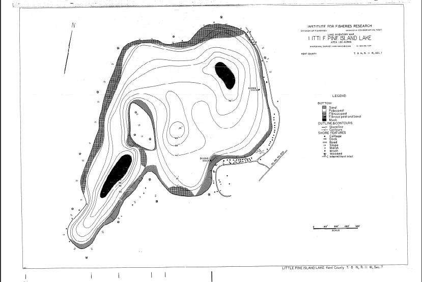
The water level of Little Pine Island lake is up to the lake property owners and other conditions, then set by petition to the State Circuit Court of Kent County. The court ruling is managed by the Kent County Drain Commission
through the authority of the Kent County Board of Commissioners
. Little Pine Island Lake level is controlled by a small dam at the lake outlet channel. The dam can be seen next to the road in between 7091 and 7079 Hass
Dr.
It takes 2/3 of the lake property owners to agree, to change the level of the lake along with other requirements under the Michigan Public Act 451 Part 307
of 1994, involving the setting of lake levels.
WHERE DOES OUR LAKE WATER COME FROM AND WHERE DOES IT GO?
The water supply into our lake comes from a variety of sources which are all related to rainfall, these are, run-off from higher elevations, springs and rainfall directly into the lake.
The Little pine island watershed is quite large, I hope to have a watershed map soon, if you have information on little pine island lakes watershed please email for posting. email: admin@littlepineislandlake.com
Little Pine Island Lake is tied into several lakes in the area starting with the closest, Mud Lake & Elk Lake to the north. Quite a bit of water comes through the wetland between Little Pine Island and Mud lake.
The next large supplier of water to our lake is from the Mead Lake area to the north west.
The rest of our lake water comes from runoff to the south and around the lake.
From our lake the water runs through the outlet channel at the east side of the lake.
It then goes underground for a short distance through the housing development, it comes out of the development and crosses pine Island Drive heading into a wetland area feeding Scott lake. The Scott lake outlet forms a stream that goes across Scott Lake Golf Course that
goes under the US 131 highway just south of the Post Drive exist/entrance. Then it goes through the housing development along Samaric Drive feeding several good size ponds and makes a beautiful creek going through the development.
The creek then crosses West River Drive at the White Pine Trail Park bridge that goes over West River Drive. Our water finally makes it way to the Grand River behind the Westwood at The Crossing restaurant
Link to a PDF view of the map below: http://www.dnr.state.mi.us/SPATIALDATALIBRARY/PDF_MAPS/INLAND_LAKE_MAPS/KENT/LITTLE_PINE_ISLAND_LAKE.PDF

|
|
|
